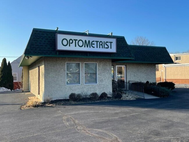
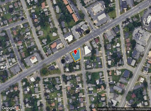
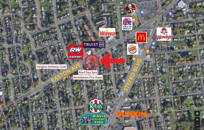
Property Record
2444 Easton Ave, Bethlehem, PA 18017
NEARBY LISTINGS FOR SALE OR LEASE
Property Detail
2444 Easton Ave
Storebuilding
Northampton
X
Pennsylvania
42095C0263E
0.27 AC
2025
Lehigh Valley
2025
Philadelphia
010601
Allentown-Bethlehem-Easton, PA-NJ
1,170 SF
N7NW4C 2 2 0204
DEMOGRAPHICS near 2444 Easton Ave
1 Mile
3 Mile
5 Mile
2024 Total Population
15,744
86,139
159,110
2029 Population
15,713
86,399
159,859
Pop Growth 2024-2029
(0.20%)
+ 0.30%
+ 0.47%
Average Age
41
41
41
2024 Total Households
6,390
33,920
61,848
HH Growth 2024-2029
(0.13%)
+ 0.32%
+ 0.54%
Median Household Inc
$71,249
$72,199
$73,402
Avg Household Size
2.40
2.30
2.40
2024 Avg HH Vehicles
2.00
2.00
2.00
Median Home Value
$220,936
$245,935
$255,241
Median Year Built
1961
1964
1965
Nearby Places
Map Layers
Map Styles
 Street
 Aerial
- Restaurants
- Banks
- Shops
- Fitness
- Groceries
PUBLIC TRANSPORTATION
AIRPORT
Lehigh Valley International
DRIVE
WALK
Distance
Lehigh Valley International
14 min
6.7 mi
Freight Ports
Port of Philadelphia
DRIVE
WALK
Distance
Port of Philadelphia
90 min
54.3 mi
SALE & LEASE HISTORY
LISTING DATE
SALE/LEASE

Nov 10, 2022
For Lease
Jan 19, 2023
For Lease
Feb 09, 2022
For Sale
Apr 29, 2022
For Lease
Nearby Properties
Address
Land Use
TOTAL SIZE
Lot Size
Zoning
Address
Land Use
TOTAL SIZE
Lot Size
Zoning
425,507 SF
52.58 AC
HI
Address
Land Use
TOTAL SIZE
Lot Size
Zoning
184,739 SF
6.75 AC
I
Address
Land Use
TOTAL SIZE
Lot Size
Zoning
29,982 SF
14.39 AC
RT
Address
Land Use
TOTAL SIZE
Lot Size
Zoning
1,197,396 SF
57.03 AC
HI
Address
Land Use
TOTAL SIZE
Lot Size
Zoning
104,379 SF
21.57 AC
CS
Address
Land Use
TOTAL SIZE
Lot Size
Zoning
12,838 SF
36.50 AC
IP
Address
Land Use
TOTAL SIZE
Lot Size
Zoning
1,200,000 SF
107.27 AC
HI
Address
Land Use
TOTAL SIZE
Lot Size
Zoning
1,710,800 SF
68.08 AC
HI
Address
Land Use
TOTAL SIZE
Lot Size
Zoning
26,653 SF
13.51 AC
HI
Address
Land Use
TOTAL SIZE
Lot Size
Zoning
800,280 SF
18.20 AC
HI
Address
Land Use
TOTAL SIZE
Lot Size
Zoning
332,641 SF
2.27 AC
HI
Address
Land Use
TOTAL SIZE
Lot Size
Zoning
52,164 SF
124.81 AC
IN
Address
Land Use
TOTAL SIZE
Lot Size
Zoning
800,250 SF
40.07 AC
HI
Address
Land Use
TOTAL SIZE
Lot Size
Zoning
676,788 SF
39.39 AC
HI
Address
Land Use
TOTAL SIZE
Lot Size
Zoning
3,400 SF
65.07 AC
RM
Address
Land Use
TOTAL SIZE
Lot Size
Zoning
524,948 SF
35.66 AC
LI
Address
Land Use
TOTAL SIZE
Lot Size
Zoning
421,883 SF
34.66 AC
HI
Address
Land Use
TOTAL SIZE
Lot Size
Zoning
347,514 SF
10.27 AC
RM
Address
Land Use
TOTAL SIZE
Lot Size
Zoning
2,726 SF
13.40 AC
RG
Address
Land Use
TOTAL SIZE
Lot Size
Zoning
168,984 SF
20.31 AC
I
Address
Land Use
TOTAL SIZE
Lot Size
Zoning
249,872 SF
41.83 AC
PC
Address
Land Use
TOTAL SIZE
Lot Size
Zoning
31,442 SF
9.87 AC
IP
Address
Land Use
TOTAL SIZE
Lot Size
Zoning
319,788 SF
60 AC
IN
Address
Land Use
TOTAL SIZE
Lot Size
Zoning
512,902 SF
35.18 AC
LI
Address
Land Use
TOTAL SIZE
Lot Size
Zoning
601,903 SF
41.68 AC
LI
Address
Land Use
TOTAL SIZE
Lot Size
Zoning
63,711 SF
31.56 AC
RR
Address
Land Use
TOTAL SIZE
Lot Size
Zoning
42,465 SF
7.28 AC
LI
Address
Land Use
TOTAL SIZE
Lot Size
Zoning
103,214 SF
2.55 AC
RT
Address
Land Use
TOTAL SIZE
Lot Size
Zoning
539,133 SF
47 AC
LI
Address
Land Use
TOTAL SIZE
Lot Size
Zoning
75,251 SF
4.76 AC
LI
The World's #1 Commercial Real Estate Marketplace
Connect with us
© 2025 CoStar Group
The information above has been obtained from sources believed reliable. While we do not doubt its accuracy we have not verified it and make no guarantee, warranty or representation about it. It is your responsibility to independently confirm its accuracy and completeness. Any projections, opinions, assumptions, or estimates used are for example only and do not represent the current or future performance of the property. The value of this transaction to you depends on tax and other factors which should be evaluated by your tax, financial, and legal advisors. You and your advisors should conduct a careful, independent investigation of the property to determine to your satisfaction the suitability of the property for your needs.